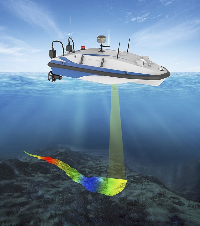
Bathymetry is the study of the bed (floor) of a waterbody, involving mapping of features on charts to provide information on water depth. Bathymetric lidar charts are typically produced to aid navigation and inform dredging activities, for example during maintenance of navigational channels.
Bathymetry traditionally uses an echosounder attached to a survey boat. As the boat drives across the survey area, the echosounder generates electrical signals that are then converted to sound waves by a transducer under water. The sound waves bounce off of the underwater features and this echo is picked up by the echosounder which then calculates the distance to the feature. The system uses high accuracy GNSS (GPS) system to then link each distance measurement to a specific depth on a map.
Bathymetric Survey Company allow us to measure the depth of water bodies as well as check the underwater features And multiple methods can be used for bathymetric lidar drone: bathymetric services, bathymetric survey services with best bathymetric.

Bathymetric Lidar Drone Services
A bathymetric drone survey can be used when typical bathymetric drone services methods cannot be used. A bathymetric survey drone can fly in the absence of an unmanned surface vessel. This implies they can supply more data from a top-down perspective when showing or mapping out the land on the seafloor. Bathymetric lidar drones map water depths and sediments significantly more quickly and cost-effectively. We are a leading bathymetric lidar drone survey services company and offer the best bathymetric drone prices.
Benefits Of Using Bathymetric Drone Services
- Use Anywhere To Deploy
- Time-Saving
- Work In Harsh Conditions
- Exact Measurements
We allows measuring the depth of a water body as well as mapping the underwater features of a water body.
